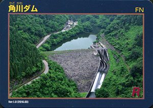
表
裏
カード種別:ダムカード非公認
配布場所:角川ダム管理所(9:00~17:00、火曜日、土日祝日、年末年始を除く)
配布日:2017年4月3日~
取得日:2017年6月13日
取得の追加事項:簡単なアンケート
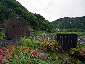
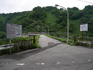
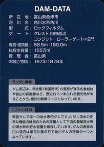
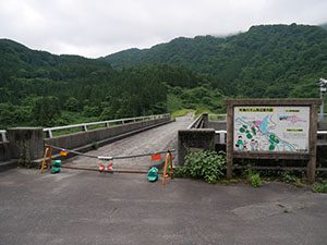
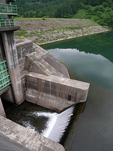
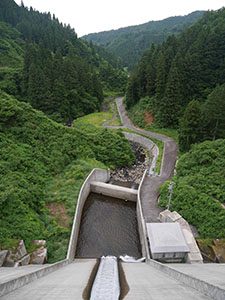
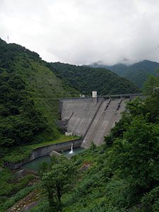
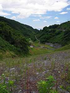
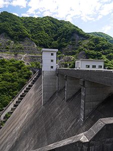
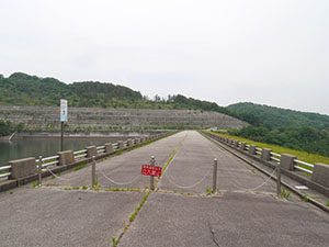
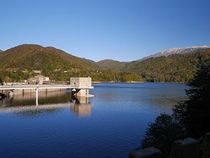
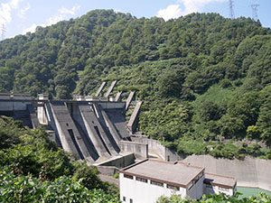
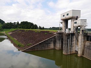
堤頂は立入禁止でクレストを見学できない
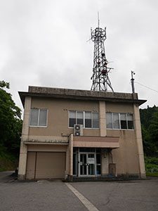
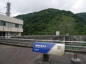
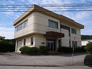
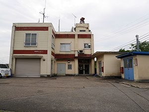
角川ダム管理所。人気がなく入口には「ダム管理員は、本日休みです。」の無情な張り紙が・・・
張り紙に書いてあったところに電話し、魚津市街の富山県魚津総合庁舎2階にある新川土木センター河川管理班を訪ねてダムカードをいただく。配布情報に記載がないが、火曜日は毎週休みのようです。
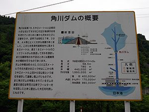
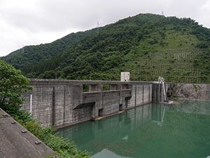
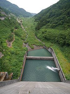
ダムデータ
所在地:富山県魚津市
河川名:角川水系角川
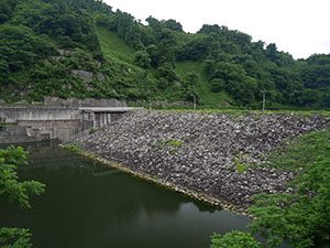
型式:ロックフィルダム
ゲート:クレスト自由放流、コンジットローラーゲートX2門
堤高:58.5m
堤頂長:180.0m
総貯水容量:155万m3
管理者:富山県
本体着工:1973年
完成年:1978年
表
裏
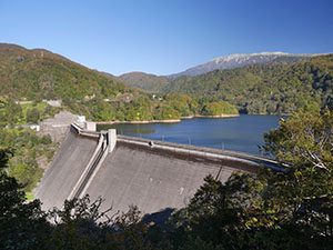
カード種別:ダムカード非公認
配布場所:布施川ダム管理所(9:00~17:00、土日祝日、年末年始を除く)
配布日:2017年4月3日~
取得日:2017年6月13日
取得の追加事項:簡単なアンケート
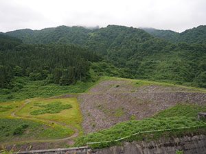
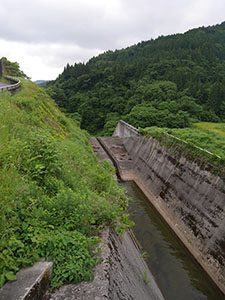
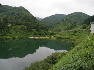
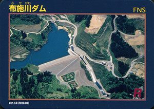
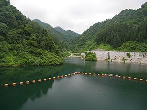
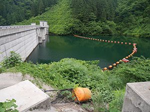
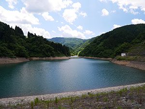
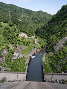
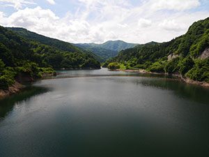
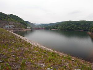
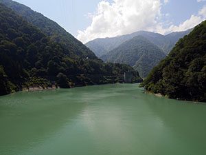
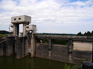
ダム湖
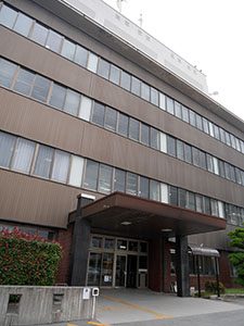
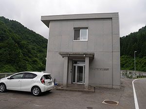
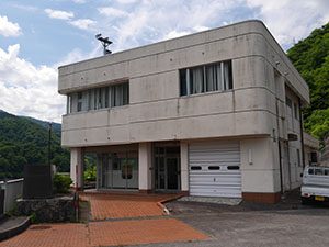
布施川ダム管理所
展示室があるが閉まっている
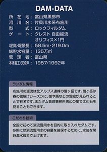
ダムデータ
所在地:富山県黒部市
河川名:片貝川水系布施川
型式:ロックフィルダム
ゲート:クレスト自由放流、オリフィスX1門
堤高:58.5m
堤頂長:219.0m
総貯水容量:135万m3
管理者:富山県
本体着工:1987年
完成年:1992年
表
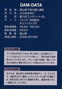
裏
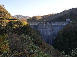
カード種別:ダムカード非公認
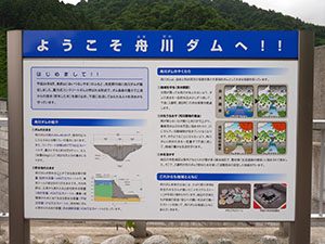
配布場所:舟川ダム管理所(9:00~17:00、土日祝日、年末年始を除く)
配布日:2017年5月上旬~
取得日:2017年6月13日
取得の追加事項:特になし
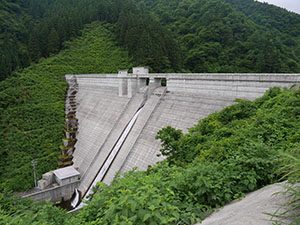
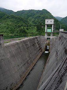
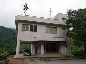
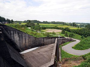
ダム湖
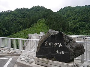
舟川ダム管理所
ダムデータ
所在地:富山県下新川郡朝日町
河川名:小川水系舟川
型式:重力式コンクリートダム
ゲート:クレスト自由放流、オリフィスX1門
堤高:49.8m
堤頂長:160.5m
総貯水容量:60万m3
管理者:富山県
本体着工:2008年
完成年:2012年
表
裏
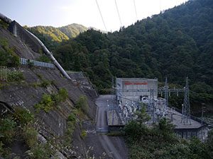
カード種別:ダムカード非公認
配布場所:朝日小川ダム管理所(9:00~17:00、土日祝日、年末年始を除く)
配布日:2017年4月3日~
取得日:2017年6月13日
取得の追加事項:特になし
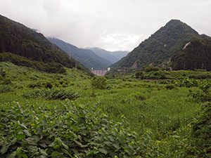
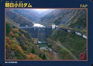
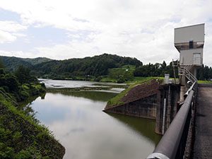
山あいにダムが見えてくる
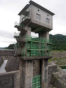
朝日小川ダム管理事務所
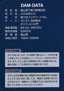
ダムデータ
所在地:富山県下新川郡朝日町
河川名:小川水系小川
型式:重力式コンクリートダム
ゲート:クレスト自由放流、オリフィスX2門
堤高:84.0m
堤頂長:260.0m
総貯水容量:528万m3
管理者:富山県
本体着工:1984年
完成年:1990年
表
裏
カード種別:ダムカード非公認
配布場所:湯谷川ダム管理事務所(9:00~15:00)
配布日:2017年4月3日~
取得日:2017年6月5日
取得の追加事項:特になし
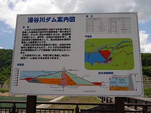
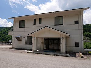
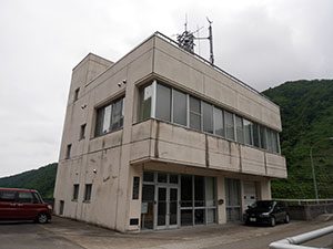
湯谷川ダム管理事務所
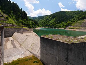
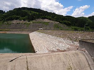
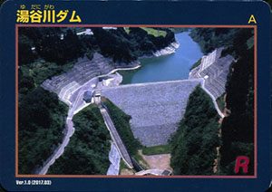
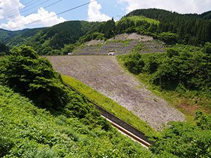
ダム湖
ダム左岸上部からはダム下流の平野が見渡せる
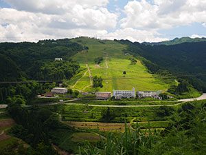
ダム湖右岸の丘陵地に広がる牛岳温泉スキー場
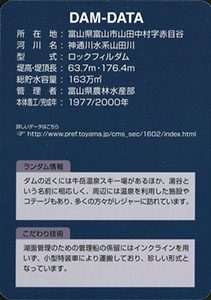
ダムデータ
所在地:富山県富山市山田中村字赤目谷
河川名:神通川水系山田川
型式:ロックフィルダム
堤高:63.7m
堤頂長:176.4m
総貯水容量:163万m3
管理者:富山県農林水産部
本体着工:1977年
完成年:2000年
表
裏
カード種別:ダムカード非公認
配布場所:久婦須川ダム管理所(9:00~17:00土日祝日、年末年始、12月上旬~4月下旬を除く)
配布日:2017年4月下旬~
取得日:2017年6月5日
取得の追加事項:特になし
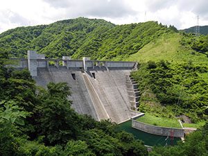
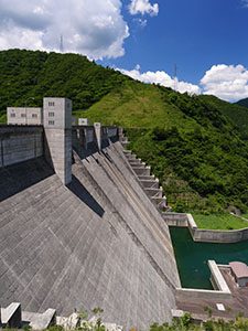
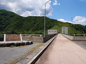
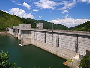
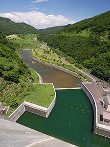
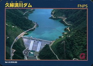
ダム湖
久婦須川ダム管理所
ダムデータ
所在地:富山県富山市
河川名:神通川水系井田川支川久婦須川
型式:重力式コンクリートダム
ゲート:クレスト自由放流、オリフィスX3門
堤高:95.0m
堤頂長:253.0m
総貯水容量:1000万m3
管理者:富山市
本体着工:1993年
完成年:2003年
表
裏
カード種別:ダムカード非公認
配布場所:熊野川ダム管理所(9:00~17:00土日祝日、年末年始、12月上旬~5月下旬を除く)
配布日:2017年5月下旬~
取得日:2017年6月5日
取得の追加事項:特になし
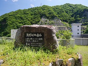
麓の熊野川ダム連絡所
ここからダムまではかなり距離がある
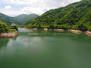
ダム湖
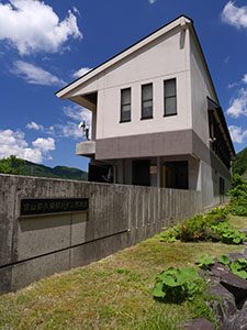
熊野川ダム管理所
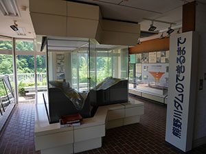
1Fは展示室になっている
ダムコンクリートの原石は上流2キロの場所から取られた
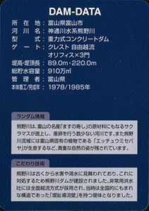
ダムデータ
所在地:富山県富山市
河川名:神通川水系熊野川
型式:重力式コンクリートダム
ゲート:クレスト自由放流、オリフィスX3門
堤高:89.0m
堤頂長:220.0m
総貯水容量:910万m3
管理者:富山県
本体着工:1978年
完成年:1985年
表
裏
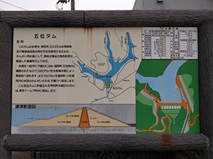
配布場所:五位ダム管理所(9:00~16:30、土・日・祝日含む)
配布日:2017年4月3日~
取得日:2017年5月24日
取得の追加事項:特になし
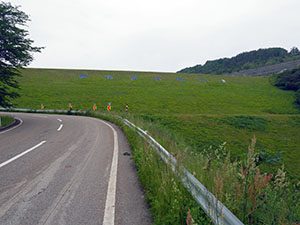
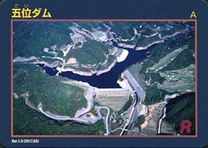
「夢の水五位ダム」と書かれている
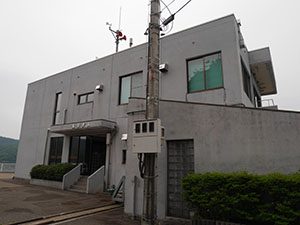
五位ダム管理所
管理所で許可をもらい堤頂を歩く
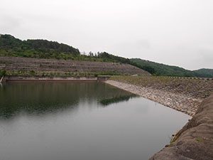
ダム湖。赤い五位山大橋が目立つ
下流の集落にかかる橋から
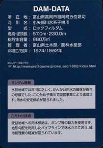
ダムデータ
所在地:富山県高岡市福岡町五位堀切
河川名:小矢部川水系子撫川
型式:ロックフィルダム
堤高:57.0m
堤頂長:230.0m
総貯水容量:880万m3
管理者:富山県土木部・農林水産部
本体着工:1974年
完成年:1992年
表
裏
配布場所:城端ダム管理所(9:00~17:00、土・日・祝日を除く)
配布日:2017年4月3日~
取得日:2017年5月23日
取得の追加事項:簡単なアンケート
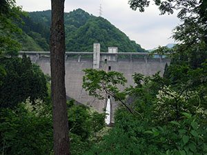
途中の道路、木の合間から正面が見えるが流路は見えない
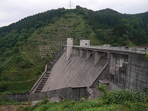
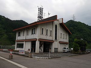
城端ダム管理所
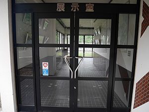
管理所の1Fは展示室になっている
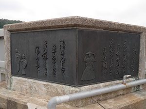
麦屋節のレリーフ
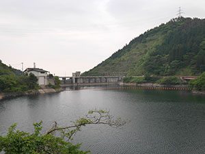
ダム湖の城端湖
城端湖展望台
ダムデータ
所在地:富山県南砺市
河川名:小矢部川水系山田川
型式:重力式コンクリートダム
ゲート:クレスト自由越流、オリフィスX1門、ローラーゲートX1門
堤高:59.0m
堤頂長:216.5m
総貯水容量:300万m3
管理者:富山県
本体着工:1986年
完成年:1992年
表
裏
カード種別:ダムカード非公認
配布場所:小矢部川ダム管理事務所2F(刀利ダム)(9:00~17:00、土・日・祝日含む)
配布日:2017年4月3日~
取得日:2017年5月23日
取得の追加事項:簡単なアンケート
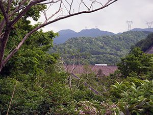
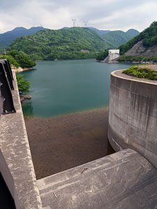
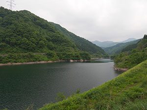
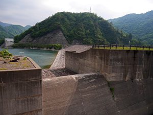
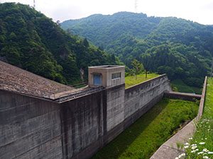
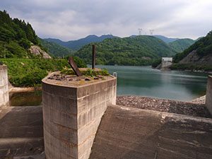
臼中集落がダム湖に沈んだ
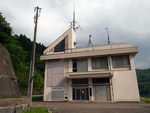
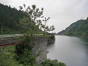
臼中ダム管理所(普段は留守)
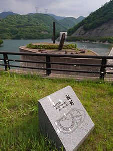
相刻という日時計の島がある
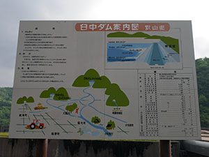
蛙の鳴き声がこだまする
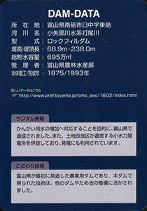
ダムデータ
所在地:富山県南砺市臼中字東島
河川名:小矢部川水系打尾川
型式:ロックフィルダム
堤高:68.9m
堤頂長:238.0m
総貯水容量:695万m3
管理者:富山県農林水産部
本体着工:1975年
完成年:1993年月3日~
取得日:2017年5月23日
取得の追加事項:簡単なアンケート
臼中集落がダム湖に沈んだ
臼中ダム管理所(普段は留守)
相刻という日時計の島がある
蛙の鳴き声がこだまする
ダムデータ
所在地:富山県南砺市臼中字東島
河川名:小矢部川水系打尾川
型式:ロックフィルダム
堤高:68.9m
堤頂長:238.0m
総貯水容量:695万m3
管理者:富山県農林水産部
本体着工:1975年
完成年:1993年
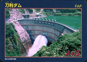
表
裏
カード種別:ダムカード非公認
配布場所:小矢部川ダム管理事務所2F(刀利ダム)(9:00~17:00、土・日・祝日含む)
配布日:2017年4月3日~
取得日:2017年5月23日
取得の追加事項:簡単なアンケート
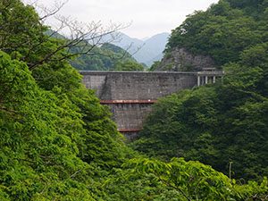
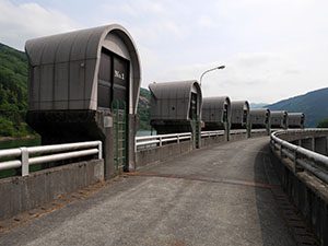
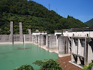
堤頂は金沢市湯涌方向へのアクセス道路になっている
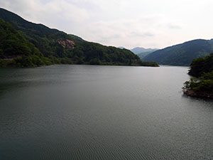
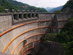
ダム湖
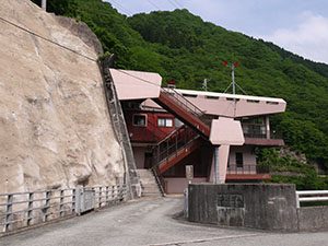
小矢部川ダム管理事務所
見学している間に音がしてきたので、覗いてみると放水していた
管理事務所で聞いたところ、梅雨時期に備えて貯水率を少し下げるため、6月1日から放水するようだ。今日は偶然そのテスト放水を見られた。何度か放水初めからフル放水、放水終了までの一連の放水を見られてラッキーであった。
ダムデータ
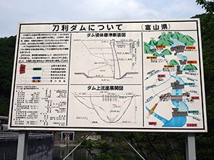
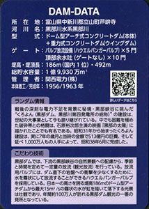
所在地:富山県南砺市刀利字大平
河川名:小矢部川
型式:ドーム型アーチ式コンクリートダム+重力式コンクリートダム
ゲート:ダム越流式ローラーゲートX6門、ハウエルバンガーバルブX1基
堤高:101.0m
堤頂長:229.4m
総貯水容量:3140万m3
管理者:富山県農林水産部
本体着工:1958年
完成年:1967年
表
裏
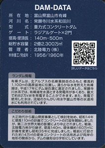
カード種別:ダムカード非公認
配布場所:有峰記念館(有料の有峰林道を通る必要あり)
配布日:2016年5月~(6月~11月上旬、有峰林道が通過可能な季節のみ)
取得日:2016年10月15日
取得の追加事項:アンケート必要
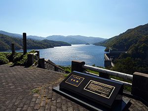
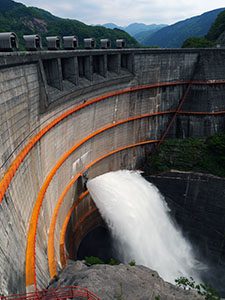
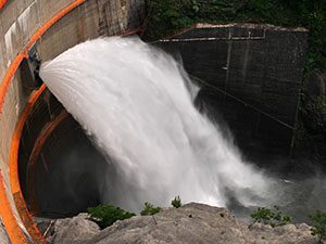
ダム展望台から有峰湖
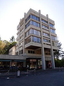
有峰記念館
有峰記念館展望台から有峰湖
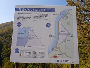
アーカイブス有峰(有峰記念館2F)
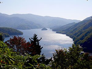
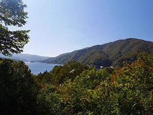
猪根山第2展望台から有峰湖
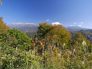
猪根山第1展望台から薬師岳(左)と北の俣岳(右)
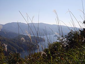
猪根山第1展望台から有峰湖
不動谷ゲート近く西岸線展望台から有峰湖
小口川線展望台から有峰ダム
祐延ダム(小口川線)
有峰第二発電所(小口川線)
小口川ダム(小口川線)
小俣ダム
常願寺川の横江頭首工
ダムデータ
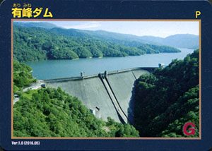
所在地:富山県富山市有峰
河川名:常願寺川水系和田川
型式:重力式コンクリートダム
ゲート:ラジアルゲートX2門
堤高:140m
堤頂長:500m
総貯水容量:2億2300万m3
管理者:北陸電力株式会社
本体着工:1956年
完成年:1960年
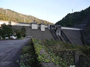
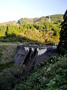
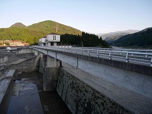
表
裏
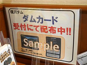
配布場所:桂湖ビジターセンター(11月下旬~5月上旬と8月以外の火曜日を除く)
配布日:2014年5月上旬~
取得日:2016年9月23日
取得の追加事項:アンケート

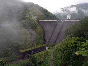
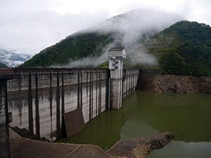
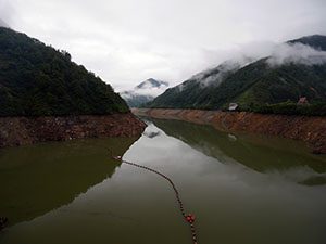
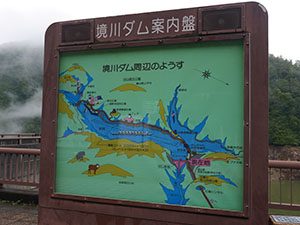
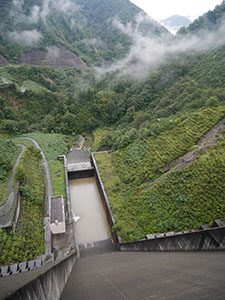
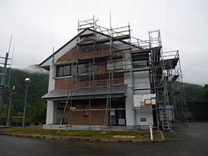
ダムサイト管理事務所
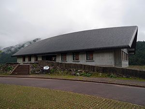
桂湖ビジターセンター
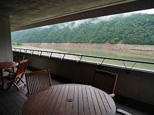
ダム湖ではボートの練習をしていた
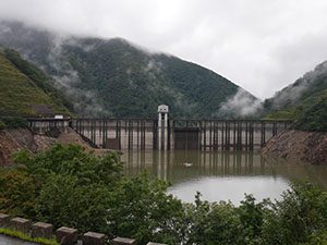
ダムデータ
所在地:富山県南砺市、岐阜県大野郡白川村
河川名:庄川水系境川
型式:重力式コンクリートダム
ゲート:クレスト自由放流
堤高:115m
堤頂長:297.5m
総貯水容量:5990万m3
管理者:富山県
本体着工:1985年
完成年:1993年
表
裏
配布場所:黒部ダムレストハウス1F売店、扇沢駅売店
配布日:2016年5月~
取得日:2016年9月22日
取得の追加事項:ダムへ行った証明として関電トンネルトロリーバス(または立山黒部アルペンルート乗車券)の提示し、裏に押印
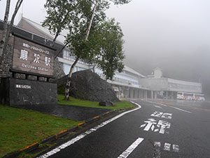
長野県側の入口、扇沢駅
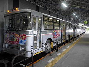
トンネルトロリーバス。バスだけど電車と同じ扱い

扇沢駅から220段の階段を上り、ダム展望台売店に至る
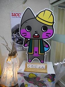
マスコットキャラクターのくろにょん
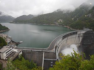
ダム展望台からの眺望
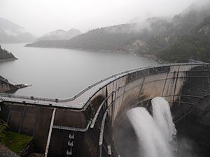
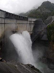
観光放水は大迫力!
新展望広場特設会場
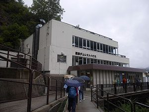
黒部ダムレストハウス
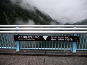
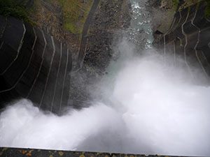
ダム中心から見た放水
ガルベ乗り場途中からの眺望

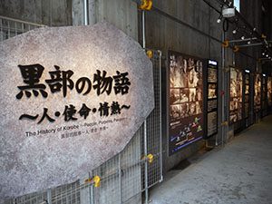
黒部の太陽の記念プレート
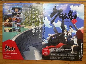
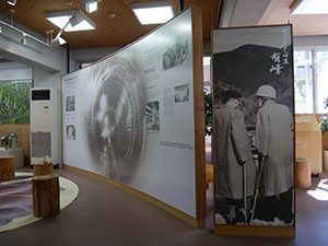
今年黒部ダムが舞台のアニメが放送され、アニメ聖地巡礼地となった
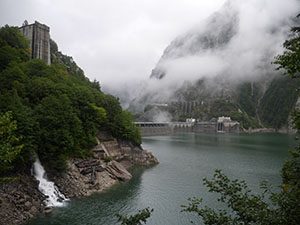
四季折々きれいな黒部峡谷
ダムデータ
所在地:富山県中新川郡立山町芦峅寺
河川名:黒部川水系黒部川
型式:ドーム型アーチ式コンクリートダム(本体)+重力式コンクリートダム(ウイングダム)
ゲート:バルブ放流設備(ハウエルバンガーバルブ)X5門、頂部余水吐(ゲートなし)X10門
堤高:186m(国内1位)
堤頂長:492m
総貯水容量:1億9930万m3
管理者:関西電力株式会社
本体着工:1956年
完成年:1963年
表
裏
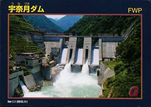
カード種別:ダムカード公認
配布場所:宇奈月ダム情報資料館「大夢来館」(9:00~16:30、年末年始を除く)
配布日:2015年11月~
取得日:2016年9月4日
取得の追加事項:なし
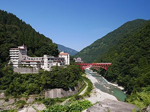
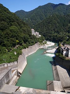
ダムの下流に宇奈月温泉郷があり、トロッコ電車の始発駅がある。トロッコ電車はダムのすぐ脇を走る。
堆積した土砂を下流に排出する拝砂ゲートを持つ。
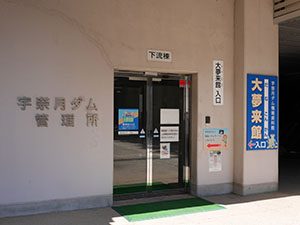
ダムカードは管理室と同じ建物にあるダム資料館「大夢来館」の受付でもらえる。
ダムデータ
所在地:富山県黒部市
河川名:黒部川水系黒部川
型式:重力式コンクリートダム
ゲート:クレストシェルスライドゲートX2門、コンジット高圧ラジアルゲートX3門、コンジット高圧スライドゲートX2門、利水放流設備ジェットフローゲート
堤高:97m
堤頂長:190m
総貯水容量:2470万m3
管理者:国土交通省
本体着工:1993年
完成年:2001年
表
裏
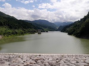
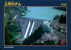
配布場所:上市川ダム管理事務所(9:00~17:00、土・日・祝日を除く)
配布日:2014年3月26日~
取得日:2016年8月24日
取得の追加事項:アンケート
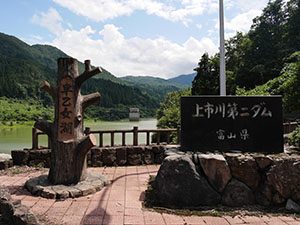
ダムデータ
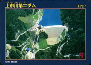
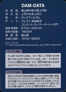
所在地:富山県中新川郡上市町
河川名:上市川水系上市川
型式:ロックフィルダム
ゲート:クレスト自由越流、コンジットローラーゲートX2門
堤高:67.0m
堤頂長:205.0m
総貯水容量:780万m3
管理者:富山県
本体着工:1979年
完成年:1985年
表
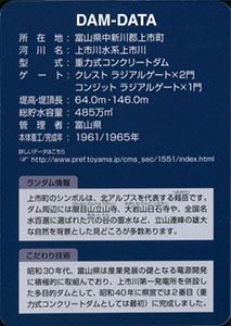
裏
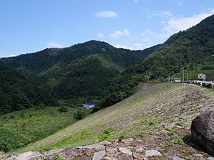
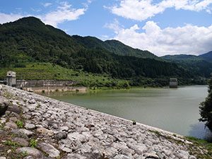
配布場所:上市川ダム管理事務所(9:00~17:00、土・日・祝日を除く)
配布日:2014年3月26日~
取得日:2016年8月24日
取得の追加事項:アンケート
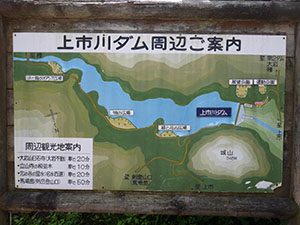
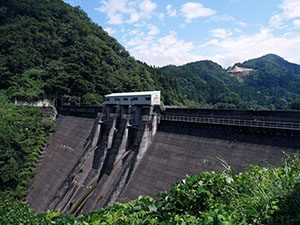
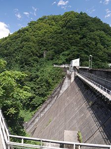
奥の山「城山」は中新川の豪族土肥氏の奥城、稲村城跡

ダムデータ
所在地:富山県中新川郡上市町
河川名:上市川水系上市川
型式:重力式コンクリートダム
ゲート:クレストラジアルゲートX2門、コンジットラジアルゲートX1門
堤高:64.0m
堤頂長:146.0m
総貯水容量:485万m3
管理者:富山県
本体着工:1961年
完成年:1965年
表
裏
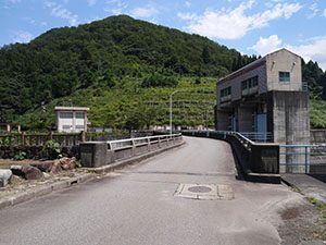
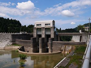
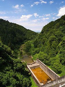
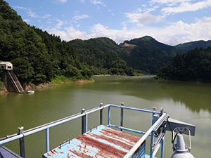
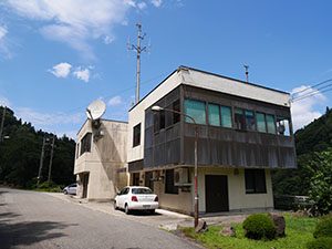
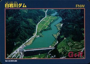
配布場所:白岩川ダム管理事務所(土・日・祝日を除く)
配布日:2014年3月26日~
取得日:2016年8月24日
取得の追加事項:アンケート
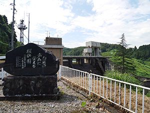
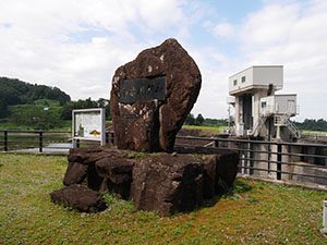
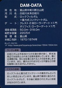
ダムデータ
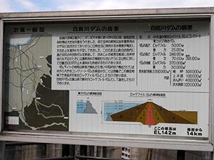
所在地:富山県中新川郡立山町
河川名:白岩川水系白岩川
型式:ロックフィルダム+重力式コンクリートダム
ゲート:クレスト2段ローラーゲートX1門、オリフィスローラーゲートX1門
堤高:50m
堤頂長:318m
総貯水容量:220万m3
管理者:富山県
本体着工:1970年
完成年:1974年
表
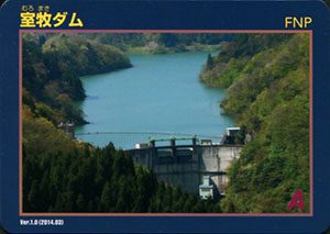
裏
配布場所:室牧ダム管理事務所(土・日・祝日を除く。11月下旬~4月下旬は通行止めのため配布しない)
配布日:2014年4月~
取得日:2016年8月24日
取得の追加事項:アンケート
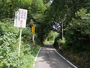
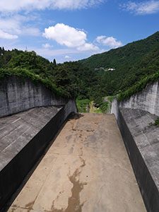
11月下旬から4月下旬までは通行止めになる入口。ポストもあるが、ここから管理事務所まで車で5分かかる。
ダムデータ
所在地:富山県富山市
河川名:神通川水系井田川
型式:アーチ式コンクリートダム
ゲート:クレストローラーゲートX2門、コンジットローラーゲートX2門
堤高:80.5m
堤頂長:153.1m
総貯水容量:1700万m3
管理者:富山県
本体着工:1959年
完成年:1961年
表
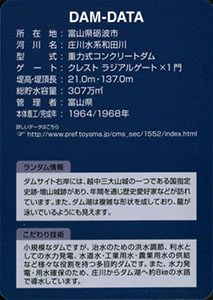
裏
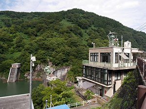
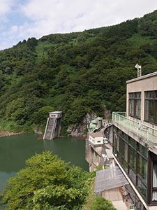
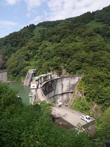
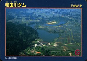
配布場所:和田川ダム管理事務所(9:00~17:00、土・日・祝日を除く)
配布日:2014年3月26日~
取得日:2016年7月5日
取得の追加事項:アンケート
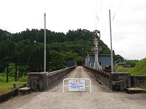
ここを渡ると国史跡増山城跡
ダムデータ
所在地:富山県砺波市
河川名:庄川水系和田川
型式:重力式コンクリートダム
ゲート:クレストラジアルゲートX1門
堤高:21.0m
堤頂長:137.0m
総貯水容量:307万m3
管理者:富山県
本体着工:1964年
完成年:1968年
何でも集めたくなるのが男のサガ(性)。ゲット!カードコレクション