表

裏
カード種別:ダムカード公認
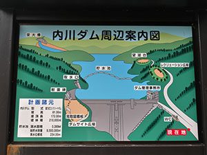
配布場所:内川ダム管理事務所
配布日:2016年8月26日~(土・日・祝日を除く。日直がいる日は配布あり)
取得日:2016年8月26日
取得の追加事項:なし
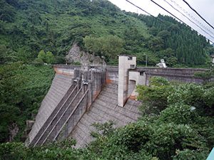
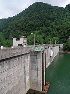

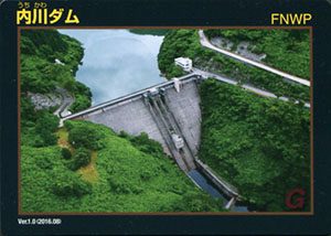
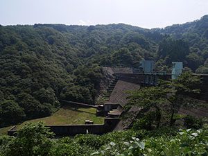
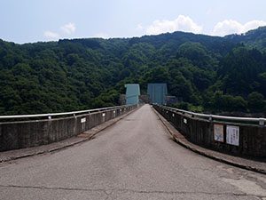
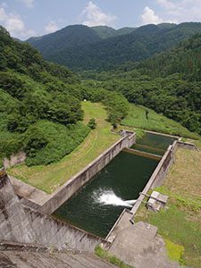
ダムデータ
所在地:石川県金沢市小原町
河川名:犀川水系内川
型式:重力式コンクリートダム
ゲート:クレストラジアルゲートX2門、コンジットラジアルゲートX1門
堤高:81m
堤頂長:172m
総貯水容量:950万m3
管理者:石川県
本体着工:1970年
完成年:1973年
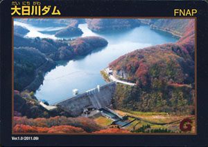
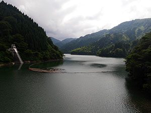
表
裏
カード種別:ダムカード公認
配布場所:大日川ダム管理事務所
配布日:2011年9月~(土・日・祝日を含む)
取得日:2016年8月7日
取得の追加事項:アンケート
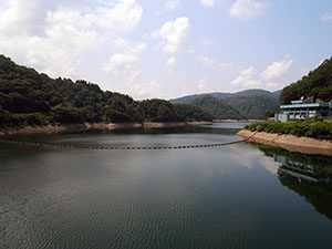
大日川第一発電所
ダムデータ
所在地:石川県白山市阿手町
河川名:手取川水系大日川
形式:重力式コンクリートダム
ゲート:表面取水用鋼製ローラーゲートX4段、取水口鋼製ローラーゲートX1門、洪水吐クレストゲートX三門、放流用ハウエルガーバルブX1門
堤高:59.9m
堤頂長:238m
総貯水容量:2720万m3
管理者:石川県
本体着工:1952年
完成年:1968年
表
裏
カード種別:ダムカード公認
配布場所:奥能登土木総合事務所分室 維持管理課(能登空港ターミナルビル3F)(9:00~17:00、土・日・祝日を除く)
配布日:2010年8月~
取得日:2016年6月29日
取得の追加事項:ダムへ行った証明(写真等)が必要
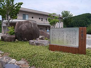
水田とともにダム湖に沈んだ弁慶谷内にあったという「弁慶石」。五穀豊穣の神として崇拝されてきた。
ダムデータ
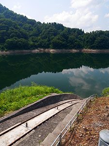
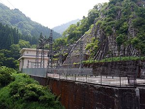
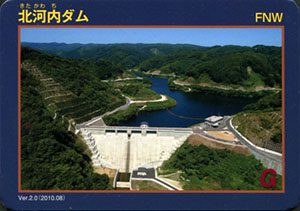
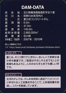
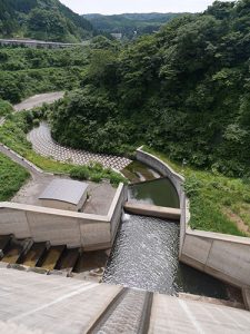
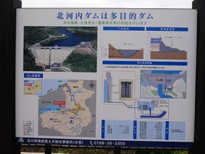
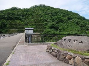
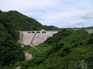
所在地:石川県鳳珠郡能登町字五十里
河川名:町野川水系河内川
型式:重力式コンクリートダム
堤頂幅:6.0m
堤高:47.0m
堤頂長:140.0m
総貯水容量:286万m3
管理者:石川県
本体着工:2007年
完成年:2010年
表
裏
配布場所:奥能登土木総合事務所分室 維持管理課(能登空港ターミナルビル3F)(9:00~17:00、土・日・祝日を除く)
配布日:2010年3月~
取得日:2016年6月29日
取得の追加事項:ダムへ行った証明(写真等)が必要
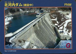
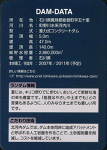
ダムデータ
所在地:石川県鳳珠郡能登町字五十里
河川名:町野川水系河内川
型式:重力式コンクリートダム
堤高:47m
堤頂長:140m
総貯水容量:286万m3
管理者:石川県
本体着工:2007年
完成年:2011年(予定)
表
裏
カード種別:ダムカード公認
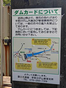
配布場所:道の駅瀬女(9:00~17:30、水曜日・年末年始を除く)、手取川総合開発記念館(9:00~16:30、木曜日を除く。12月~3月休館)、白山砂防科学館(9:00~17:00、木曜日・年末年始を除く)
配布日:2007年7月~
取得日:2016年6月5日
取得の追加事項:なし
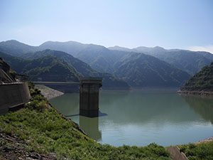
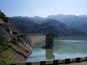
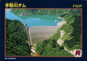
ダムデータ
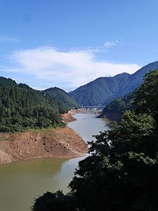
所在地:石川県白山市
河川名:手取川水系手取川
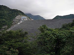
形式:ロックフィルダム
ゲート:選択取水設備鋼製5段式半円形ローラゲート、クレストローラーゲートX2門、放流設備ジェットフローゲート、維持放流設備ジェットフローゲート
堤高:153m
堤頂長:420m
総貯水容量:2億3100万m3
管理者:国土交通省・電源開発(株)
本体着工:1975年
完成年:1980年
何でも集めたくなるのが男のサガ(性)。ゲット!カードコレクション