表
裏
配布場所:鳥取県中部総合事務所 県土整備局河川砂防課(9:00~17:00、土日祝日・年末年始を除く)
配布日:2015年5月~
取得日:2020年10月21日
取得の追加事項:現地写真の証明が必要
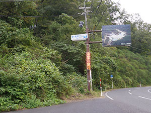
道路標識を見つけてダムへ向かう。
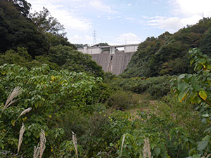
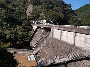
途中堤体が見えた。
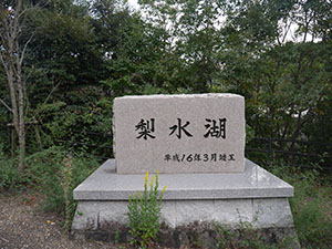
駐車場に着くと梨水湖の石碑が建っていた。
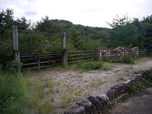
他にダムの案内看板があったと思われる枠が残っていたが、他に銘板もなく東郷ダムとわかるものは「東郷ダム管理事務所」の道路標識のみだった。
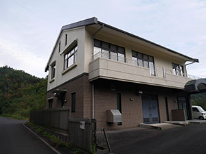
管理事務所
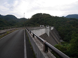
堤体はかなりの大きさ
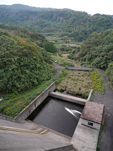
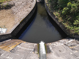
放水路
堤体は途中で屈曲している珍しい形
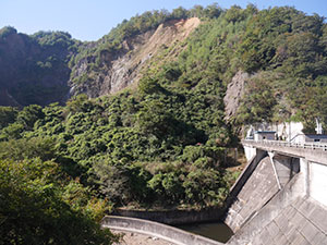
堤体を奥まで進むと日本海が見えた。
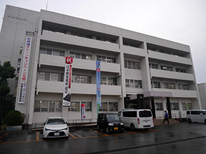
鳥取県中部総合事務所
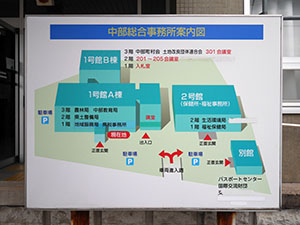
左の建物1号館A棟の2階に県土整備局河川砂防課があった。写真を見せてカードをもらう。
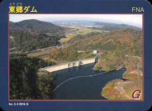
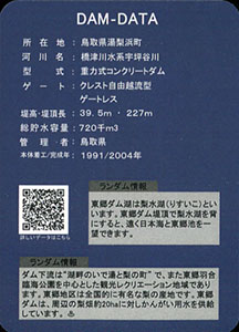
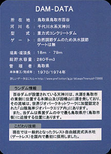
ダムデータ
所在地:鳥取県湯梨浜町
河川名:橋津川水系宇坪谷川
型式:重力式コンクリートダム
ゲート:クレスト自由越流型ゲートレス
堤高:39.5m
堤頂長:227m
総貯水容量:720千m3
管理者:鳥取県
本体着工:1991年
完成年:2004年
表
裏
配布場所:山陰海岸ジオパーク推進協議会事務局、道の駅 てんきてんき丹後、玄武洞公園案内所、香美町立ジオパークと海の文化館、新温泉町ジオパーク館、鳥取県立海と大地の自然館、岩美町立渚交流館、鳥取砂丘ビジターセンター、あおや郷土館
配布日:2019年10月
取得日:2020年10月21日
取得の追加事項:配布希望の申出及びアンケート回答
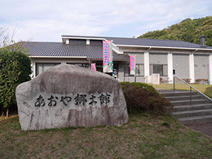
配布場所で最初に訪れたあおや郷土館。4種類のカードのうちこのカードのみ配布中だった。
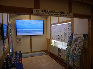
館内に展示コーナーがある。ここの展示は広くはないが、山陰海岸ジオパークは配布しているチラシが豊富だ。
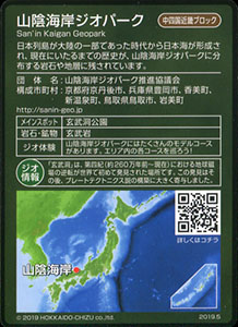
ジオパークデータ
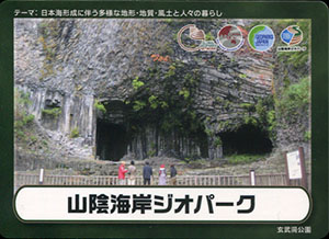
テーマ:日本海形成に伴う多様な地形・地質・風土と人々の暮らし
団体名:山陰海岸ジオパーク推進協議会
構成市町村:京都府京丹後市、兵庫県豊岡市、香美町、新温泉町、鳥取県鳥取市、岩美町
メインスポット:玄武洞公園
岩石・鉱物:玄武岩
ジオ体験:山陰海岸ジオパークにはたくさんのモデルコースがあります。エリア内の各コースを巡ろう!
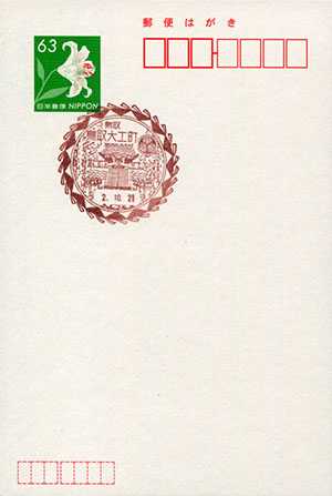
鳥取大工町郵便局風景印
使用開始日:2020年10月14日
図案の説明:しゃんしゃん傘の模様を外枠とし、鳥取東照宮を描く。
住所:鳥取県鳥取市大工町頭17
開局日:2016年4月20日(意匠変更)
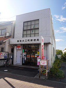
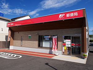
鳥取大工町郵便局
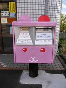
ポストもうさぎ。県内にいくつかあるようだ。
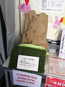
局内にはうさぎの砂像
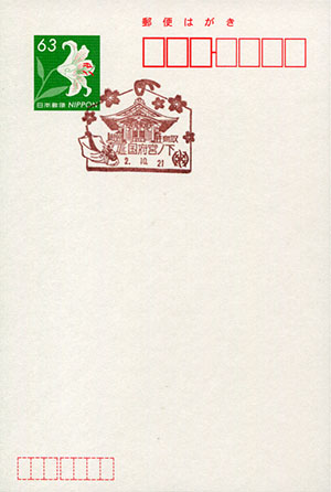
国府宮ノ下郵便局風景印
使用開始日:2020年3月23日
図案の説明:絵馬を外枠とし、中央に因幡地方の一の宮である宇倍神社、左下に伝統芸能の麒麟獅子舞、右下に宇倍神社の社紋である亀崩しの紋を描く。
住所:鳥取県鳥取市国府町奥谷3丁目310-2
開局日:2020年3月23日(移転・局名変更)
国府宮ノ下郵便局
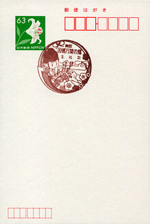
因幡万葉の郷郵便局風景印
使用開始日:2020年6月15日
図案の説明:当局の近くには因幡国庁跡があり、万葉集を編纂したといわれる大伴家持が国守として赴任した地であることから周辺地域は「万葉の郷」と称されている。因幡国庁跡を囲む因幡三山(面影山・今木山・甑山)を背景に、中央に大伴家持が新春を祝う歌(万葉集を締めくくる歌として広く知られている)を配し、新春をイメージした梅の木とウグイス、万葉集をイメージした因州和紙と水引を取り入れている。
住所:鳥取県鳥取市国府町町屋255-6
開局日:2020年6月15日(局名変更)
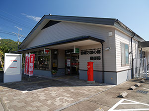
因幡万葉の郷郵便局
表
裏
カード種別:ダムカード公認
配布場所:鳥取県鳥取県土整備事務所維持管理課(9:00~17:00、土日祝日・年末年始を除く)、佐治川ダム管理事務所(9:00~17:00、土日祝日・年末年始を含む)
配布日:2014年4月~
取得日:2020年10月21日
取得の追加事項:現地写真の証明が必要
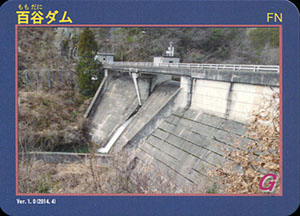
堤体に到着。奥で工事中だった。
堤体
山の斜面が大きく崩れている。土砂崩れだろうか
クレスト自由越流式洪水吐を国内で最初に採用したダムだそうだ。
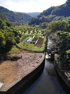
下流のほうまでは見渡せない。
ダム湖
堤体のダム湖側
鳥取県鳥取県土整備事務所の3階にある維持管理課で写真を見せてカードをもらう。
ダムデータ
所在地:鳥取県鳥取市百谷
河川名:千代川水系天神川
型式:重力式コンクリートダム
ゲート:自然調節ダムのため洪水調節ゲートは無
堤高:18m
堤頂長:79m
総貯水容量:280千m3
管理者:鳥取県
本体着工:1970年
完成年:1974年
表
裏
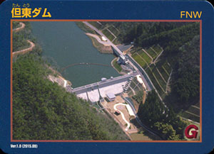
カード種別:ダムカード公認
配布場所:豊岡土木事務所河川砂防課(9:00~17:00、土日祝日・年末年始を除く)
配布日:2015年9月~
取得日:2020年10月21日
取得の追加事項:特になし
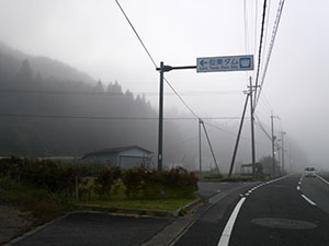
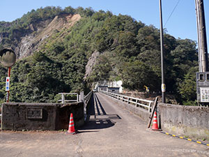
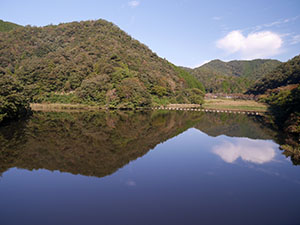
鳥取に行く途中にダムに寄って写真を撮る。
放射冷却で深い霧に覆われている。
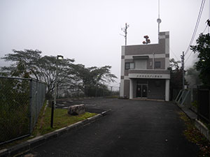
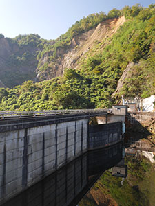
管理事務所は普段無人でカード配布場所は離れている。
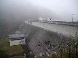
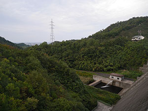
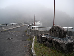
堤体
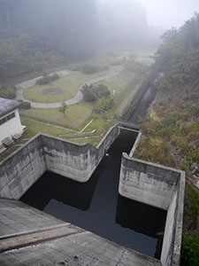
放水路
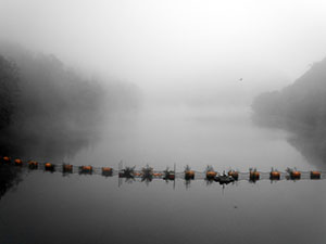
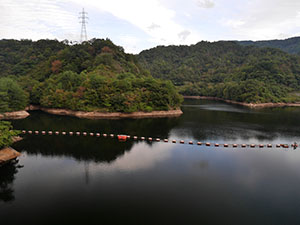
ダム湖のよこたに湖
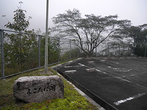
管理事務所前によこたに湖の石碑
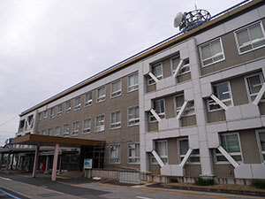
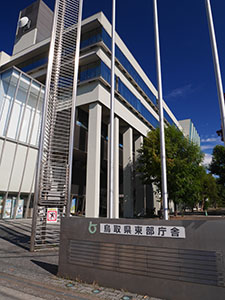
兵庫県豊岡総合庁舎の3階に豊岡土木事務所河川砂防課があった。翌日に訪問しカードをもらう。
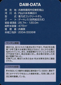
ダムデータ
所在地:兵庫県豊岡市但東町畑山
河川名:円山川水系猪谷川
型式:重力式コンクリートダム
ゲート:ゲートレス(自然越流方式)
堤高:25.7m
堤頂長:120.0m
総貯水容量:47万m3
管理者:兵庫県
本体着工:2004年
完成年:2006年
何でも集めたくなるのが男のサガ(性)。ゲット!カードコレクション