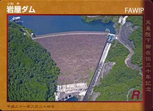
表
裏
カード種別:ダムカード公認
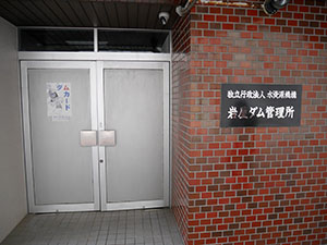
配布場所:岩屋ダム管理所
配布日:2019年2月24日~2019年5月31日(8:30~17:00)
取得日:2019年4月28日
取得の追加事項:特になし
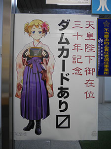
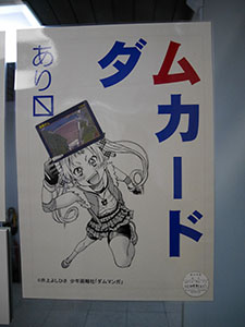
配布期間中限定で新しいダムむすめ?のポスターが掲示されている。
記念ダムカードはVer.2.0を基本に、黄櫨染のデザインとなっている。
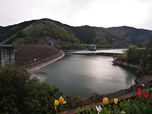
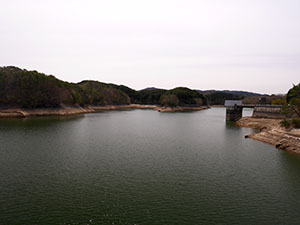
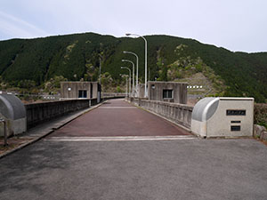
薄暗くなってきていたが、少しダムを見学していく。
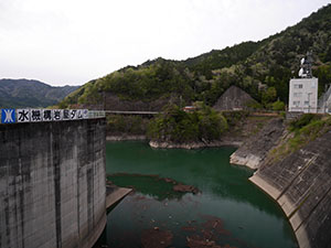
水は流れていなかった。
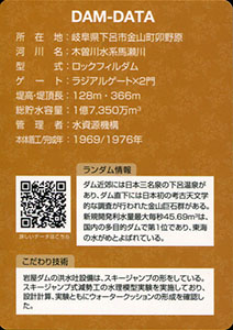
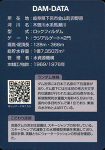
ダムデータ
所在地:岐阜県下呂市金山町卯野原
河川名:木曽川水系馬瀬川
型式:ロックフィルダム
ゲート:ラジアルゲートX2門
堤高:128m
堤頂長:366m
総貯水容量:1億7350万m3
管理者:水資源機構
本体着工:1969年
完成年:1976年
表
裏
カード種別:ダムカード公認
配布場所:岩屋ダム管理所(8:30~17:00、土・日・祝日含む)
配布日:2018年4月~
取得日:2019年4月28日
取得の追加事項:特になし
岩屋ダム管理所に閉鎖2分前にギリギリ到着した。
バージョンアップしたダムカードを入手する。
ダムデータ
所在地:岐阜県下呂市金山町卯野原
河川名:木曽川水系馬瀬川
型式:ロックフィルダム
ゲート:ラジアルゲートX2門
堤高:128m
堤頂長:366m
総貯水容量:1億7350万m3
管理者:水資源機構
本体着工:1969年
完成年:1976年
表
裏
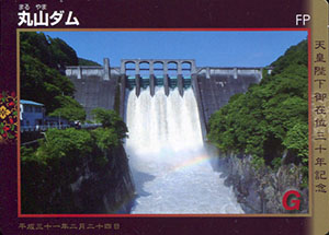
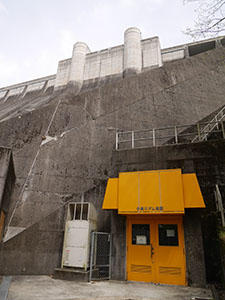
カード種別:ダムカード公認
配布場所:丸山ダム管理所
配布日:2019年2月24日~2019年5月31日(平日8:30~17:15、年末年始を除く)
取得日:2019年4月28日
取得の追加事項:特になし
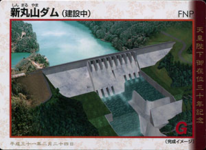
記念ダムカードはVer.1.0を基本に、帛のデザインとなっている。
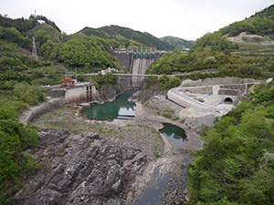
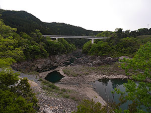
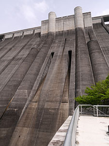
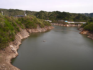
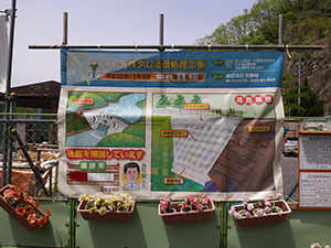
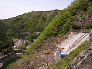
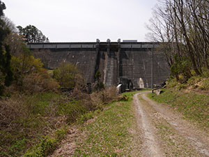
新しく完成した県道から丸山ダム周辺を望む。
右下に仮配水路トンネル、左上に新丸山ダム管理所が造られている。新丸山ダムの堤体工事にはまだ取り掛かっていないが、堤体ができれば今の丸山ダム管理所は水没するのだろうか。
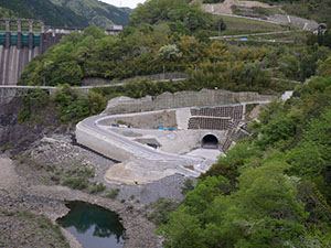
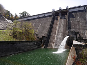
仮排水路トンネルの完成は近く見える。
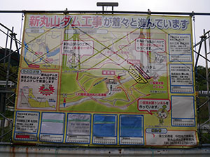
現状の工事状況を示した幕。
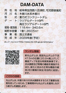
ダムデータ
所在地:岐阜県加茂郡八百津町、岐阜県可児郡御嵩町
河川名:木曽川水系木曽川
型式:重力式コンクリートダム
ゲート:ラジアルゲートX9門、高圧ラジアルゲートX8門
堤高:118.4m
堤頂長:340.6m
総貯水容量:1億1350万m3
事業者:国土交通省
完成年:2029年度(予定)
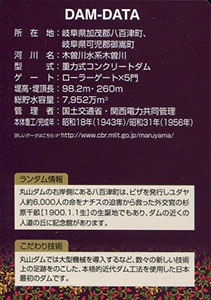
表
裏
カード種別:ダムカード公認
配布場所:丸山ダム管理所
配布日:2019年2月24日~2019年5月31日(平日8:30~17:15、年末年始を除く)
取得日:2019年4月28日
取得の追加事項:特になし
丸山ダム管理所で丸山ダムと新丸山ダムのダムカードをもらう。
記念ダムカードはVer.2.0を基本に、お召し列車のデザインとなっている。
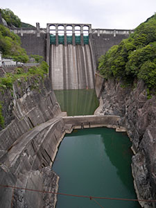
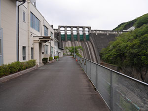
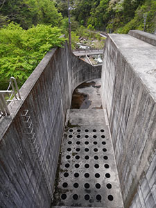
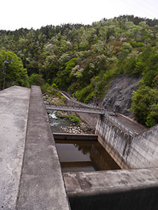
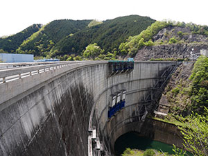
ダム堤体
下流を望むと県道の付け替え工事が終わって開通している。
ダムデータ
所在地:岐阜県加茂郡八百津町、岐阜県可児郡御嵩町
河川名:木曽川水系木曽川
型式:重力式コンクリートダム
ゲート:ローラーゲートX5門
堤高:98.2m
堤頂長:260m
総貯水容量:7952万m3
管理者:国土交通省・関西電力共同管理
本体着工:1943年
完成年:1956年
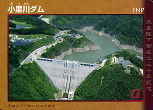
表
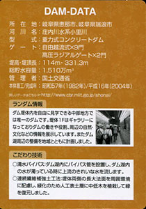
裏
配布場所:小里川ダム管理支所
配布日:2019年2月24日~2019年5月31日(平日8:30~17:15、土日祝日9:00~16:00、年末年始を除く)
取得日:2019年4月28日
取得の追加事項:特になし
記念ダムカードはVer.1.0を基本に、黄櫨染のデザインとなっている。
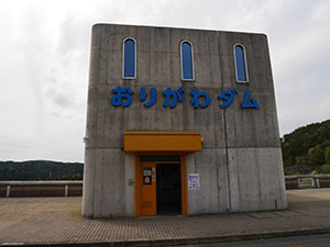
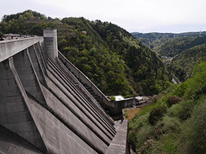
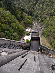
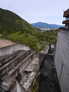
堤体天端の堤体入口。ここからエレベーターで下に降りる。
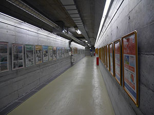
堤体内の1階ギャラリーはパネル展示が中心で、堤体前に出る通路になっている。
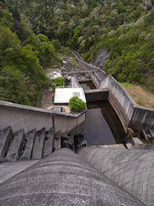
通路から出ると堤体の前に出た。
見上げると堤体の高さを実感できる。見下ろすのと見上げるのはまた違う。
流路を間近で見られる。
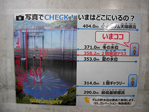
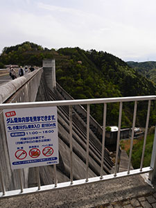
2階展望テラスに寄ってみる。
展望テラスから下を望む。
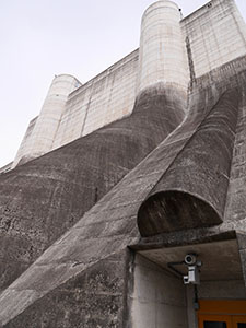
上を見上げる。
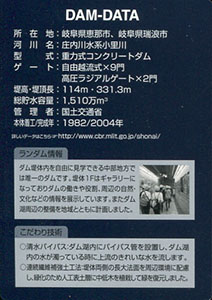
ダムデータ
所在地:岐阜県恵那市、岐阜県瑞浪市
河川名:庄内川水系小里川
型式:重力式コンクリートダム
ゲート:自由越流式X9門、高圧ラジアルゲートX2門
堤高:114m
堤頂長:331.3m
総貯水容量:1510万m3
管理者:国土交通省
本体着工:1982年
完成年:2004年
表
裏
配布場所:小里川ダム管理支所
配布日:2007年7月~(平日8:30~17:15、土日祝日9:00~16:00、年末年始を除く)
取得日:2019年4月28日
取得の追加事項:特になし
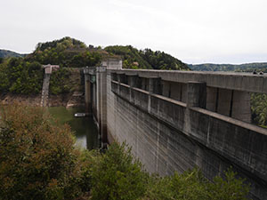
堤体
堤体内を見学できるということで多くの人が訪れている。中の様子は記念カードのほうで
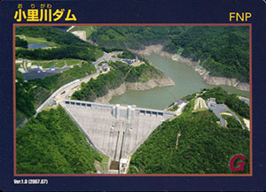
ダム湖のおりがわ湖。管理支所と道の駅が吊橋でつながっている。
堤体は高い
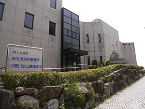
小里川ダム管理支所

吊り橋からは堤体のダム湖側が正面に見えるが、揺れるのが・・・
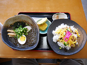
道の駅「おばあちゃん市・山岡」では特産の細寒天で作った寒天ラーメンセットが人気です。
ダムデータ
所在地:岐阜県恵那市、岐阜県瑞浪市
河川名:庄内川水系小里川
型式:重力式コンクリートダム
ゲート:自由越流式X9門、高圧ラジアルゲートX2門
堤高:114m
堤頂長:331.3m
総貯水容量:1510万m3
管理者:国土交通省
本体着工:1982年
完成年:2004年
表
裏
配布場所:マレットハウスいっぷく(8:00~17:00、水曜日、祝日の時はその翌日、年末年始を除く)
配布日:2017年7月~
取得日:2019年4月28日
取得の追加事項:特になし
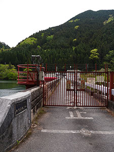
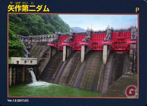
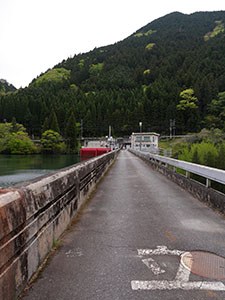
矢作ダムの下流に矢作第二ダム。無人のため堤体には入れない。
堤体通路
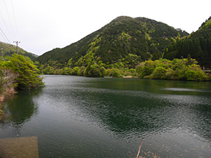
ダム湖
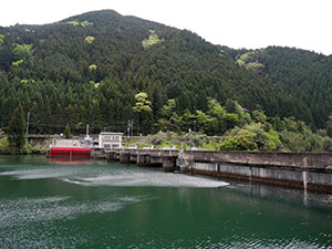
堤体のダム湖側
堤体の下流側
道路からしか見られないが、草木が繁茂し見える場所が限られる。
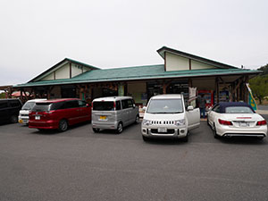
カードは15分ほど離れたマレットハウスいっぷく
ダムデータ
所在地:愛知県豊田市、岐阜県恵那市
河川名:矢作川水系矢作川
型式:重力式コンクリートダム
ゲート:ラジアルゲートX4門
堤高:38.0m
堤頂長:149.2m
総貯水容量:435.4万m3(建設時)
管理者:中部電力
本体着工:1969年
完成年:1971年
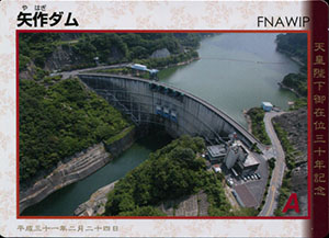
表
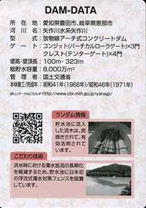
裏
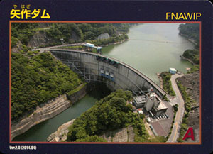
配布場所:矢作ダム管理所(8:30~17:15)
配布日:2019年2月24日~2019年5月31日
取得日:2019年4月28日
取得の追加事項:特になし
記念ダムカードはVer.2.0を基本に、帛のデザインとなっている。
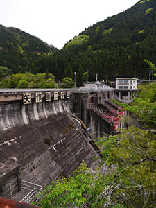
管理所下に「国土交通省矢作ダム」と書かれている。
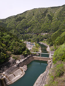
下流を望む
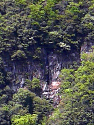
正面の岩肌に串原の七つ滝に数えられる「甘恋の滝」がある。
望遠で見ても今日は流れていない。大雨の時のみ流れる滝らしい。元は「雨乞の滝」なんだろうな。
その滝付近から正面のダムを見る。
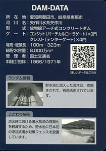
ダムデータ
所在地:愛知県豊田市、岐阜県恵那市
河川名:矢作川水系矢作川
型式:放物線アーチ式コンクリートダム
ゲート:コンジット(バーチカルローラゲート)X3門、クレスト(テンターゲート)X4門
堤高:100m
堤頂長:323m
総貯水容量:8000万m3
管理者:国土交通省
本体着工:1966年
完成年:1971年
表
裏
配布場所:矢作ダム管理所(8:30~17:15)
配布日:2014年4月~
取得日:2019年4月28日
取得の追加事項:特になし
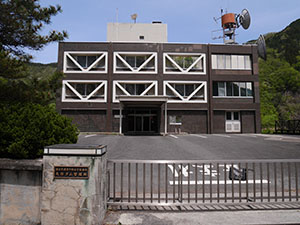
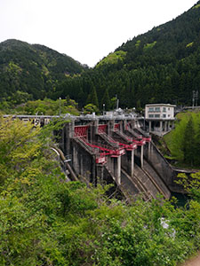
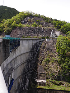
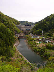
矢作ダム管理所
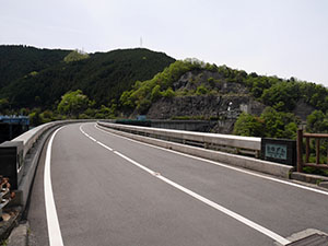
管理所前から堤体上に片側一車線の道路が続いている。反対側に見学所があるようだ。
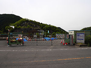
行ってみると、見学所は閉鎖されていた。
ダム法面工事中
工事中
行けるギリギリのところから堤体を望む
ダム湖に沿って堤体まで来たので途中、広いダム湖の向こうに堤体を見た。
右方に見えるのが日本初の沈殿式濁水対策フェンスらしい。
ダムデータ
所在地:愛知県豊田市、岐阜県恵那市
河川名:矢作川水系矢作川
型式:放物線アーチ式コンクリートダム
ゲート:コンジット(バーチカルローラゲート)X3門、クレスト(テンターゲート)X4門
堤高:100m
堤頂長:323m
総貯水容量:8000万m3
管理者:国土交通省
本体着工:1966年
完成年:1971年
表
裏
配布場所:いなぶ観光協会 観光案内所(9:00~17:00、年末年始休み)
配布日:2017年7月~
取得日:2019年4月28日
取得の追加事項:簡単なアンケート
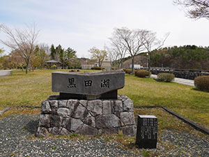
地図ではこちらが公園になっていたので黒田湖のほうに先に来ました。
残念ながら堤体には入れません。
ダム湖の水は毎日貯められては放水されるという揚水発電ダムになる。早朝ほど満水に近い状態を見られる。
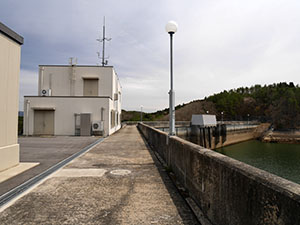
堤体正面にも道がありそうだったので行ってみる。
かなり堤体の近くまで近づける。
帰りに子供のダムカード集めに付き合わされた家族に出逢った。
道の駅「どんぐりの里いなぶ」
道の駅内にある観光案内所でダムカードをもらえる。
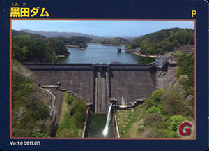
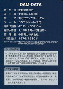
ダムデータ
所在地:愛知県豊田市
河川名:矢作川水系黒田川
型式:重力式コンクリートダム
ゲート:ラジアルゲートX2門
堤高:45.2m
堤頂長:332.0m
総貯水容量:1108.8万m3(建設時)
管理者:中部電力
本体着工:1976年
完成年:1980年
表
裏
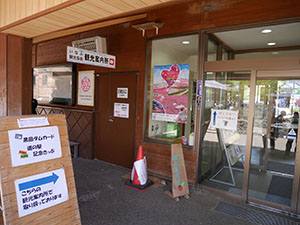
配布場所:阿木川ダム管理所(8:00~17:00)
配布日:2019年2月24日~2019年5月31日
取得日:2019年4月28日
取得の追加事項:特になし
阿木川ダム管理所で通常カードと2枚セットでもらう。
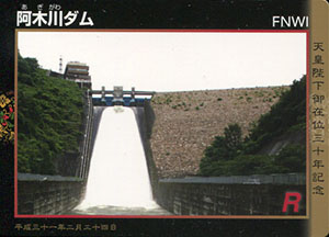
記念ダムカードはVer.1.0を基本に、宝物のデザインとなっている。
堤体を歩く。
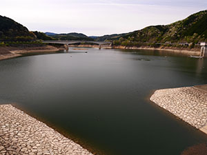
阿木川湖の水位は低いようだ。
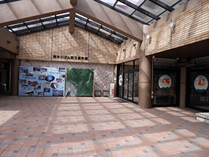
阿木川ダム防災資料館では展示を見られる。
ダムデータ
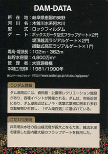
所在地:岐阜県恵那市東野
河川名:木曽川水系阿木川
型式:ロックフィルダム
ゲート:ボックスガータ型式フラップゲートX2門、堤頂越流ラジアルゲートX2門、摺動式高圧ラジアルゲートX1門
堤高:102m
堤頂長:362m
総貯水容量:4800万m3
管理者:水資源機構
本体着工:1981年
完成年:1990年
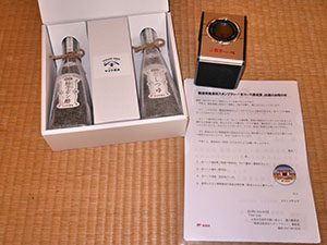
今日、昨年の能登の郵便局風景印スタンプラリーの景品が届きました。
能登の特産品と、達成認定証、達成記念缶バッジと能登ふるさと博グッズの4点です。昨年は能登立国1300年とあって大盤振る舞いでした。ちなみに達成NOは37番でした。
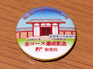
達成記念缶バッジ
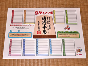
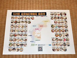
一緒に今年の能登ふるさと博のパンフと、郵便局風景印スタンプラリーの案内が入っていました。
今年もスタンプラリーあるようで、缶バッジは一新され、色彩が統一されていい感じです。
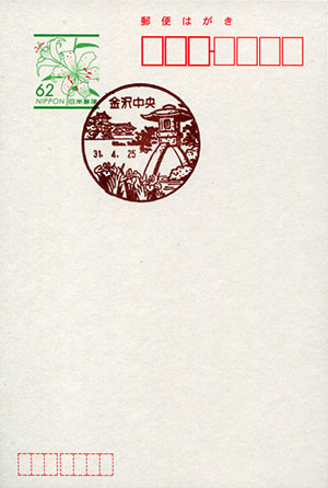
金沢中央郵便局風景印
使用開始日:1967年6月1日
図案の説明:金沢城石川門を背景に、兼六園のことじ燈籠とハナショウブを配す。
住所:石川県金沢市三社町1-1
開局日:1967年6月1日(金沢郵便局から改称)
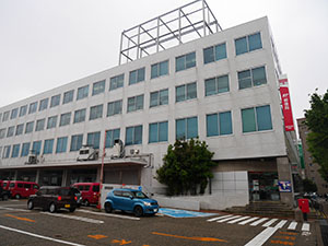
金沢中央郵便局
改元日の風景印押印について質問があったのだが、ゆうゆう窓口では押印していないとのこと。郵便窓口は7時から15時までということで間に合うかな?
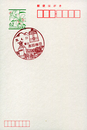
高岡横田郵便局風景印
使用開始日:1982年3月1日
図案の説明:国定公園二上山と市の名所「よこたはし」を描き、釣り鐘とアジサイを配す。
住所:富山県高岡市横田町1-1-12
開局日:不明
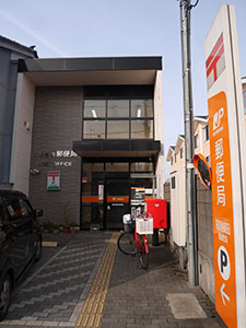
高岡横田郵便局
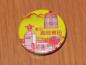
缶バッジ
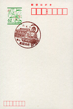
高岡本町郵便局風景印
使用開始日:1982年4月1日
図案の説明:高岡大仏と土蔵づくりの家を描き、アジサイを配す。
住所:富山県高岡市本町10-15
開局日:不明
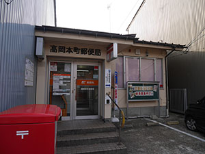
高岡本町郵便局
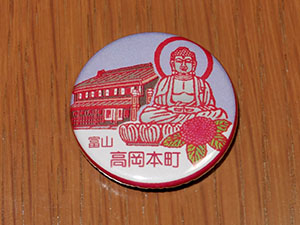
缶バッジ
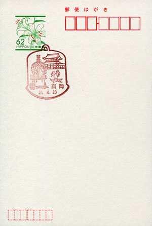
高岡郵便局風景印
使用開始日:不明
図案の説明:高岡銅器の釣鐘の外枠に国宝「瑞龍寺」、国指定重要文化財「御車山の山車」、市花「カタクリ(カタカゴ)」を配す。
住所:富山県高岡市御馬出町34
開局日:不明
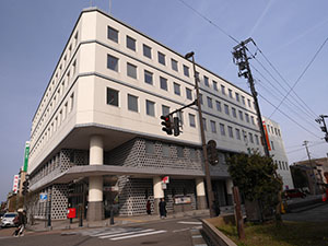
高岡郵便局
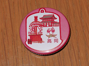
缶バッジ
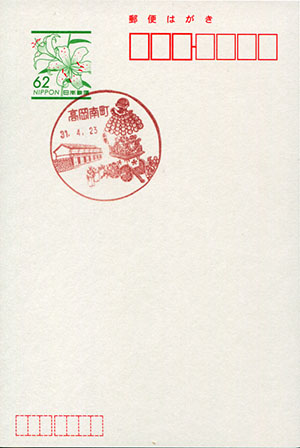
高岡南町郵便局風景印
使用開始日:1990年10月1日
図案の説明:高岡御車山曳きと御車山収蔵庫を描く。
住所:富山県高岡市南幸町3-7
開局日:不明
高岡南町郵便局
郵便局前の通りは南から北への一方通行で、郵便局を通り過ぎて少し先の駐車場の中に1台駐車できる場所がある。
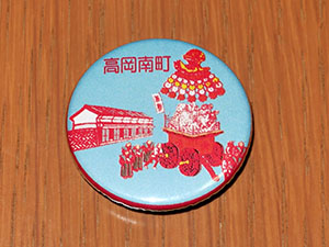
缶バッジ
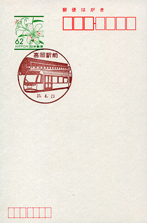
高岡駅前郵便局風景印
使用開始日:不明
図案の説明:新しく整備された高岡駅前の風景に万葉線電車「アイトラム」を配す。
住所:富山県高岡市下関町2-23-1
開局日:不明
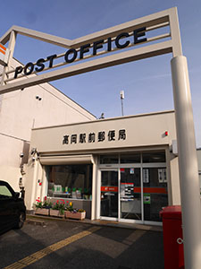
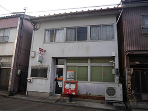
高岡駅前郵便局
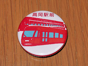
缶バッジ
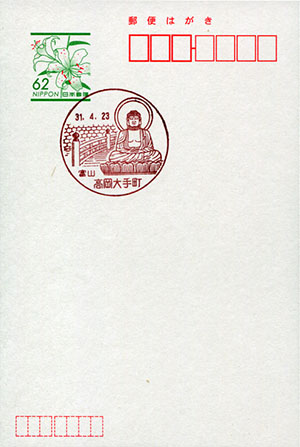
高岡大手町郵便局風景印
使用開始日:1986年7月23日
図案の説明:高岡大仏と高岡古城公園の朝陽橋を配す。
住所:富山県高岡市大手町11-2
開局日:不明
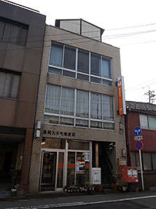
高岡大手町郵便局
高岡古城公園のすぐ南の通りにあり、街中のため駐車場は少し離れた場所に1台用意されているが、探すのに時間を要した。
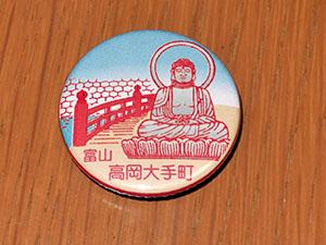
缶バッジ
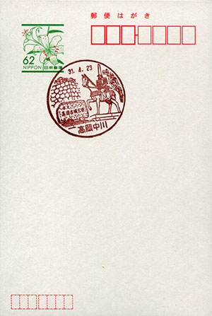
高岡中川郵便局風景印
使用開始日:1986年10月1日
図案の説明:高岡城開城の祖前田利長公の像と高岡古城公園の碑を配す。
住所:富山県高岡市中川本町14-38
開局日:不明
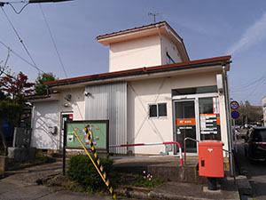
高岡中川郵便局
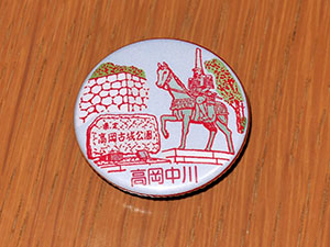
缶バッジ
何でも集めたくなるのが男のサガ(性)。ゲット!カードコレクション